Building & Bylaw ServicesCorporate Services Current PlanningDrinking Water & Watershed ProtectionEconomic DevelopmentEmergency ServicesEnergy & SustainabilityGIS/MappingLong Range PlanningParksRecreationRegional TransitSolid Waste and RecyclingWastewater ServicesWater & Utility ServicesServices by Others
Backgrounder

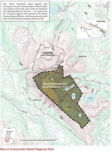
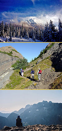
Mount Arrowsmith Management Plan BackgrounderEstablished in November 2008, Mount Arrowsmith Massif Regional Park is situated on the mid-western edge of the Regional District of Nanaimo Electoral Area C. It is approximately 40km from Qualicum Beach and 30km from Port Alberni, and is a prominent landscape feature seen from both Port Alberni and the communities of east central Vancouver Island. Geography The 1300 hectare park encompasses two key peaks of Central Vancouver Island: Mount Arrowsmith (elevation 1,817m/5,962ft) and Mount Cokely (elevation 1,616m/5,301ft) - see map. The park property abuts privatelyowned forestry lands to the east, south and west and to the north is bordered by Mount Arrowsmith Regional Park operated by the Alberni Clayoquot Regional District (ACRD).Natural Values The park’s natural ecosystems are among the most significant on Vancouver Island. Mount Arrowsmith Massif Regional Park is recognized as:Recreational Values Sources suggest that Mount Arrowsmith is one of the most popular recreation mountains on Vancouver Island. Its location makes it accessible to a broad population and the park has multiple trail routes that provide hiking opportunities for all levels of experience and fitness. Additional recreation experiences include technical climbing, snowshoeing, skiing, lake fishing, nature appreciation and photography.Historical Values Mount Arrowsmith is known as “Kuth-Kah-Chulth” to the Hupacasath First Nation which translates to “that which has sharp pointed faces.” Documented ascents of the mountain are recorded as early as 1887, and in 1912, the CPR developed a pack trail and overnight hut to accommodate tourism - the trail remains a popular ascent route today. After many years of interest by local stakeholders and public, the RDN secured a Tenure from the Province in 2009 to establish Mount Arrowsmith Massif Regional Park. 
What to Do if You Have Questions, Ideas or Concerns
Please contact Lesya Fesiak, Park Planner via one of the methods below:
|
|


